Welcome to Terra South Africa Suv'eran Assembly
We are designed to be FREE men and women, living on the Land.
Our intended life, is and was designed to be prosperous and to have simple rules. This will enable self governance that results in peace and unity in our communities.
For decades, we have been led to believe that government exists to serve the people—a concept promising governance by, for, and of the people. This idea was presented as a way to correct the injustices of past governance by those who supposedly had our best interests at heart. We were assured that, by electing individuals to public office, they would work for us, manage infrastructure, and create a stable economic environment to promote a better quality of life.
However, the COVID-19 pandemic in 2020 exposed the fragility of this assumption. Rather than transparency and accountability, we have continued to live under a cloud of secrecy. The right to vote, intended to empower us with democratic choice, appears instead to perpetuate a cycle where our Natural and Unalienable rights are not truly secured by elected “representatives.” The time has come to critically examine this system and reconsider our path forward.
Since the dawn of civilization, mankind has witnessed a struggle between forces of good and evil, each vying to control the world for their own purposes. History has shown us empires rising and falling, often under leaders who promised security but instead imposed oppression. When oppression became unbearable, patriots would rise to fight for freedom, often at the cost of lives and property. Unfortunately, this cycle has repeated, each time with the same outcomes, as people relinquish their freedoms only to reclaim them later at great cost. Ultimately, we must come to understand that true freedom lies in self-governance, not in placing our lives in the hands of overseers.
Meets and Bounds
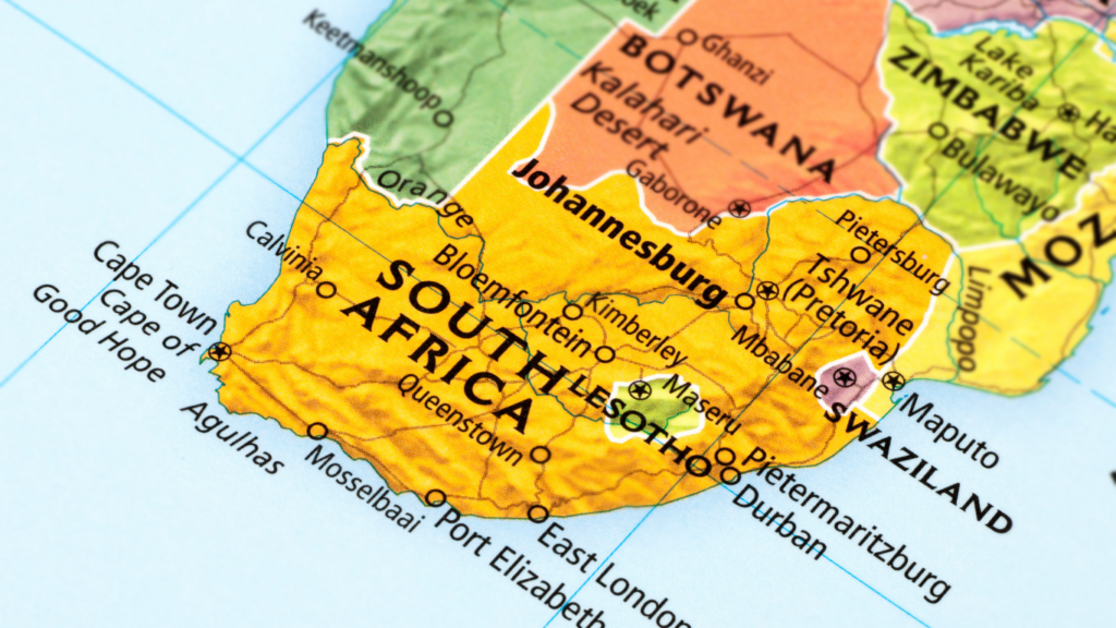
Terra South Africa, is the southernmost country of Africa. It is bounded to the south by 2,798 kilometers (1,739 mi) of coastline that stretches along the South Atlantic and Indian Oceans. To the north by the neighboring countries of Namibia, Botswana, and Zimbabwe; and to the east and north-east by Mozambique and Eswatini (Swaziland). It also completely enclaves the country Lesotho.
Terra South Africa has never had full independence as an entire landmass.
The Khoe-Sān ethnic group had full independence in the southern Cape until 1652 with the arrival of the Dutch East India Company and Jan van Riebeeck as administrator. This corporation ran the political affairs of the southern Cape. As men/women later fled the corporations control, they migrated north and north-east and met Bantu ethnic groups migrating south at different places.
Although there were various treaties made, it appears that Britain ignored these treaties and took over the political landscape, with Terra South Africa being a vassal to Britain post the 2nd Boer war until 1910. By this stage there were already a few huge corporations running the political affairs. Independence in 1961 did not give full independence, as the country continued to be governed by corporations.